Dear Guests
Dear Guests
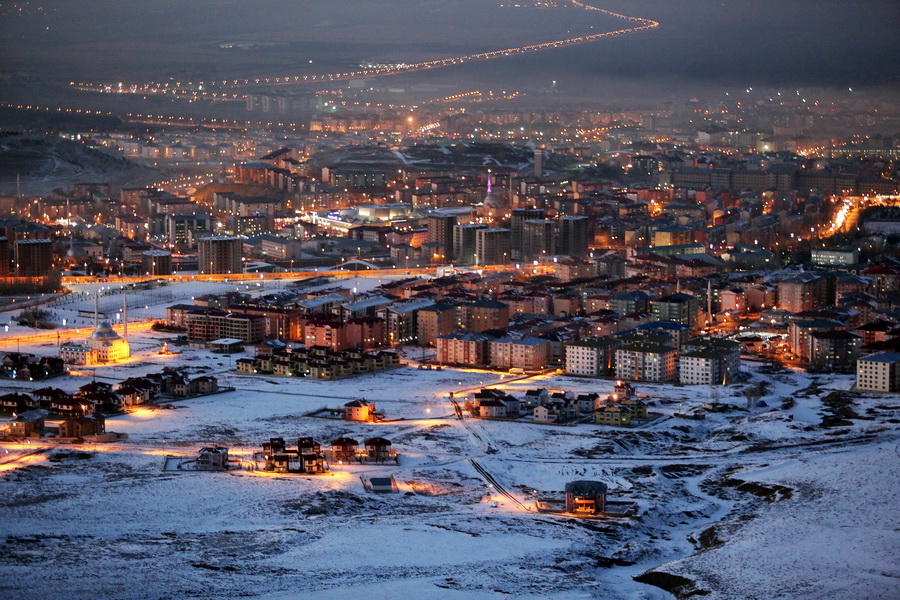
Erzurum, the largest city in the Eastern Anatolia, is a very old settlement. Located at mountainside of the Palandöken, the city has come into prominence for winter tourism in recent years. The city, incorporating many historical monuments, has an important tourism potential today.
History of Erzurum
It is estimated that Erzurum, the largest city in Eastern Anatolia, was founded in 4900 BC. The region, which includes Erzurum, has been ruled by various tribes and nations throughout history such as Urartian’s, Cimmerians, Scythians, Medes, Persians, Romans, Sassanid’s, Arabs, Seljuk’s, Byzantines, Sassanid’s, Mongols, Ilkhaniads and Safavids.
The Ottomans conquered the city and its neighborhood in 1514 and they governed this territory until the foundation of the Republic of Turkey, 1923. Erzurum Congress, a turning point for national struggle, unity and independence was held in here in 23 July 1919.
Geography of Erzurum
When compared to the central and western part of Turkey, Erzurum has the highest altitude. Rize Mountains, which are the eastern extensions of the Eastern Black Sea Mountains, surround the province from the north and form the border with Rize.
These impassable and gigantesque mountains lie in the form of regular rows parallel to the Black Sea. The highest points are Kackar and Vercenik Hills with 3937m.
Güvercin Mountain is towards Tortum; Karga Pazarı Mountain is the one between the Pasinler Plain and the Georgian Strait. It surrounds Erzurum from the east and reaches the Palandöken Mountains. Erzurum is located within extreme humide continental climate. The average annual temperature of the province is about 6.0 degrees.
Tourism of Erzurum
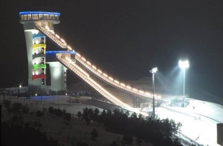
Palandöken Ski Centre, one of the most important ski centers of the country, is within the borders of Erzurum Province.
Historical Places
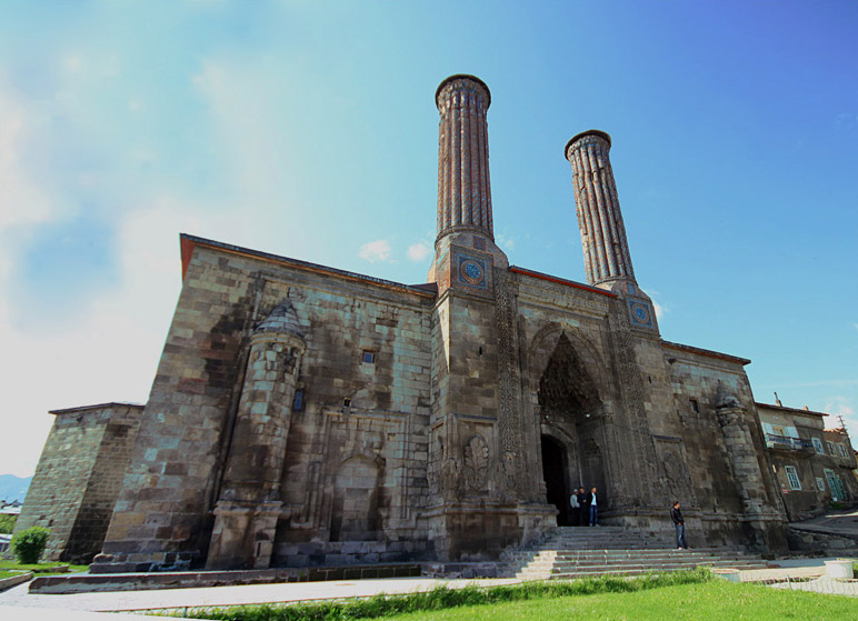
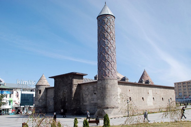
Horasan - Pasinler, which is 79 km from Erzurum, is on the historical Silk Road. The first construction date of the Erzurum Castle is unknown but it is estimated that it was built by the Byzantines in the first half of the 5th century. The Clock Tower, which was built as a minaret to the inner castle mosque, is also called Tepsi Minaret and Kule. The Clock Tower within the walls of Erzurum Castle, located on a hill, has the panaromic view of the city. It was built in 1297-98 by Emir Shepherd Salduz, the Vizier of Ilkhanids Empire. It is an important monument built on the Aras River with 7 arches. It was built by Rüstem Pasha, Grand Vizier of Suleiman the Magnificent. This two-storey building, which has the characteristics of Ottoman architecture, is still used as a bazaar. In the bazaar, mostly oltu stone salesmen are trading.
Madrasahs
It was built by the Ilkhanids Empire at the end of the 13th century. With its two-storey, two-minaret education institution and an open courtyard this madrasah was constructed according to the Anatolian Seljuk Architecture tradition and it is known as the largest madrasah in Anatolia. It was built in 1310 AD by Celaleddin Yakut. It is one of the rare works remaining from the Ilkhanids Empire period to the present day. It is designed as a Museum of Islamic Art.
Mosques and Churches
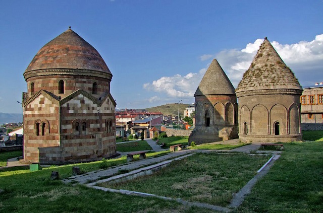
Lalapaşa Mosque, Three Domes and Oşvank Church, located within the city center, are worth seeing. It is believed that one of three domes that was built on an eight-square plan belongs to Emir Saltuk, the founder of the Saltuk State. The arhitechts of the two other domes,made entirely of face stone, are not known. However, it is estimated that the domes date back to the end of the 13th century and the beginning of the 14th century. In terms of their different planning, materials and decorations, these three Domes have a unique place within the Turkish architectural history.
Picnic Areas
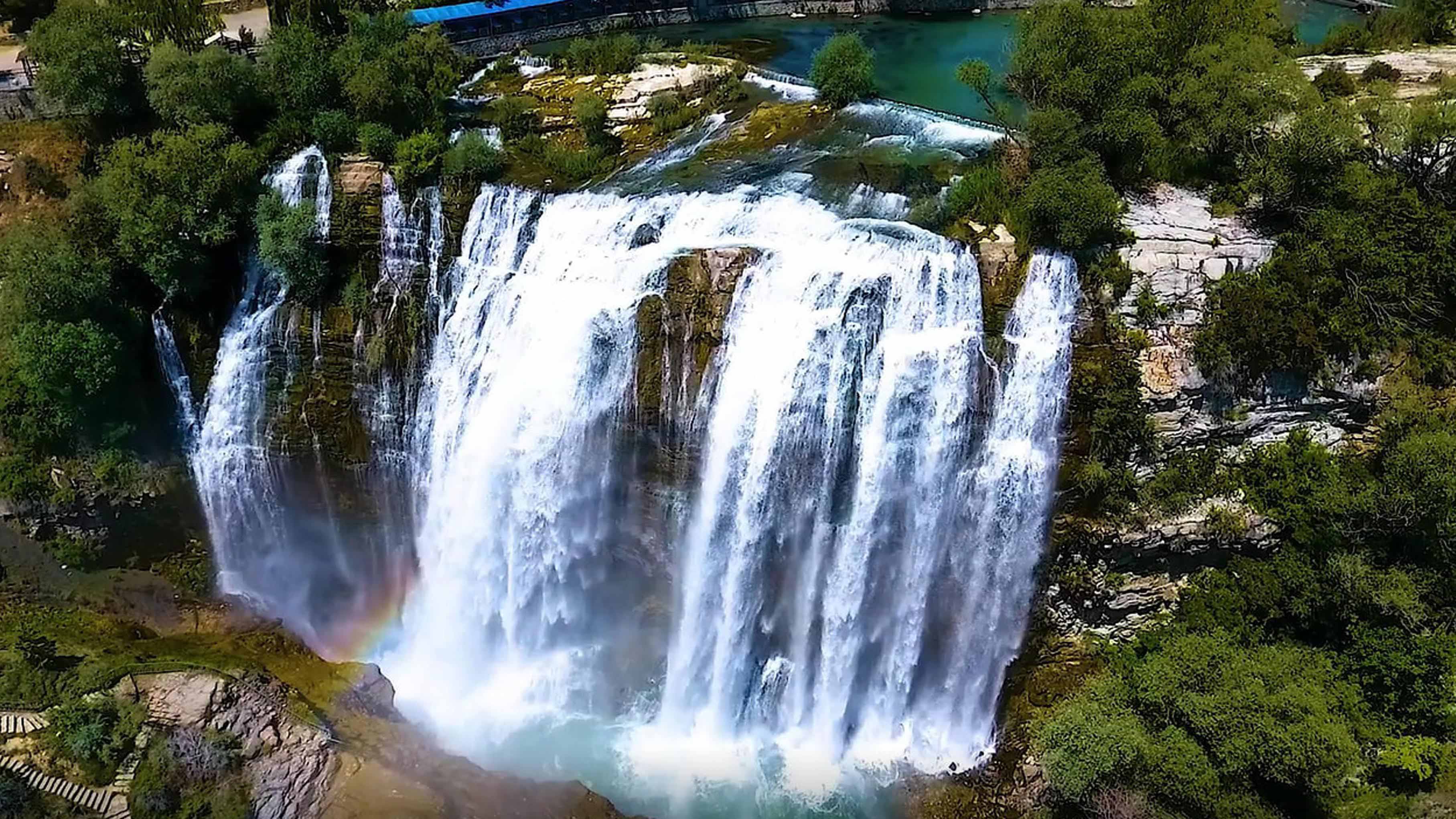
Tortum Waterfall is a wonder of nature cascading into Lake Tortum. It is also the highest and most beautiful waterfall in Turkey, one of the world's largest waterfalls. It arose following a landslide off a mountain in the valley, which cut off the stream's flow, and is situated 105 km from Erzurum. In spring when water is abundant, the natural scenery and the majesty of the waterfall willl definetly amaze its viewer. Other recreational areas worth seeing are as follow; Pasinler Thermal Spring, Bird Watching Area, Eastern Black Sea Mountains, Erzurum Plain ...
Sportive Activities
River Çoruh passing through the boundaries of Erzurum's İspir district is one of the fastest flowing rivers, just ideal for rafting. Çoruh, which attracts attention with its deep canyons, is visited by many tourists every year. In 1993, the World Rafting Championship was held on the Çoruh River. On the Dumlu Mountains located in the north of Erzurum, foreign tourists go hiking.
Those who go hiking during a three-hour walk reach to a spring called Dumlu Baba that is one of the important bayous of the Euphrates River where the quests rest a while. Then they walk through the village of Kırkgöze. Palandöken Mountains also serve at cross purposes.
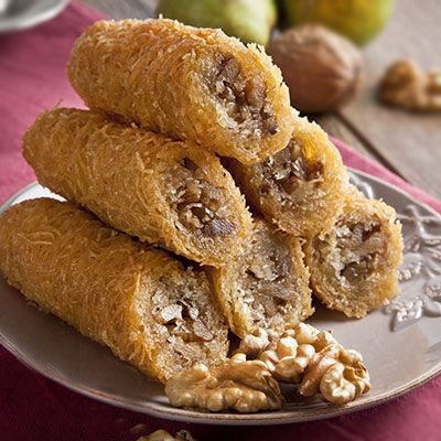
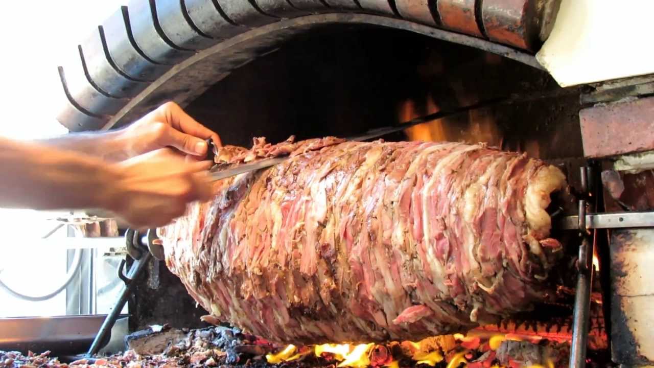
Erzurum Cuisine
Every region of Anatolia has its own regional cuisine. Erzurum has a rich cuisine culture. ‘’Lor dolması, kadayıf dolması, su böreği, ayran aşı’’ and ‘’cag kebab’’ are the main dishes of this cuisine. Those who are planning to visit Erzurum are recommended to taste these dishes, especially the famous Tortum Cağ kebab.
 Merhaba, ben Kartanesi sana yardımcı olabilmek için burdayım, Yapmak istediğin işlemi seçebilir misin?